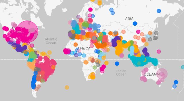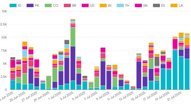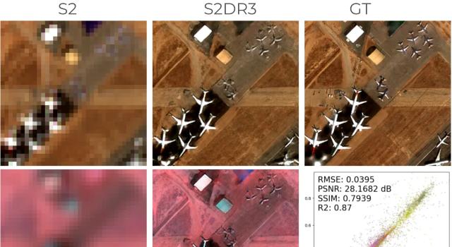
Earth Observation satellites capture petabytes of imagery at the expense of hundreds of millions of dollars, yet most pixels remain too coarse, cloudy or costly for the vast majority of practical applications, spanning the domains of agriculture, forestry, and urban development. This gap stalls climate adaptation, precision farming and resilient infrastructure, burning billions and imperilling sustainability goals. Gamma Earth, led by AI scientist and entrepreneur Yosef Akhtman and imaging exec Lorenzo Martelletti, turns free ESA Sentinel data into high-resolution, radiometrically calibrated, cloud-free maps with patented super-resolution, cloud removal and the ecoMandala foundation model, used by thousands of projects around the world and targeting EO markets of >$10 B.