


Current infrastructure planning and design (such as roads, railways, powerlines, wind&solar etc.), is time consuming, slow, untransparent and inefficient. In addition, multiple technical and economical aspects must be considered. All this has a negative impact on project roll-out.
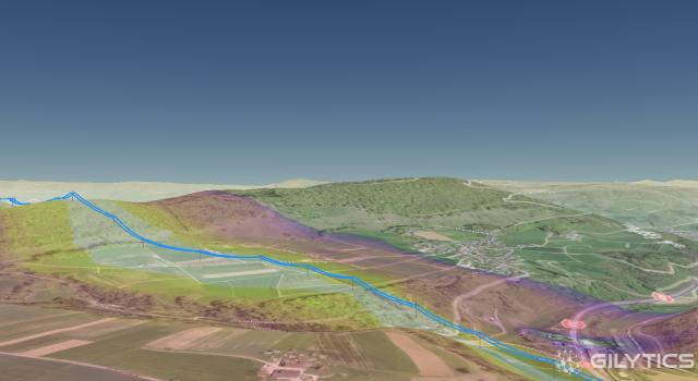
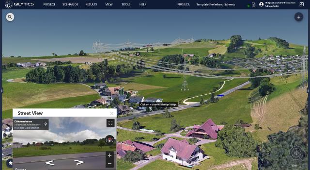
Gilytics provides a 3D interactive and automated cloud solution to design and identify optimal layout of infrastructure with the usage of GIS data and to improve the communication with stakeholders with the use of 3D visualization with AR/VR technologies.
Benefits: project alternatives generated in minutes vs. weeks/months. More than 50% planning costs saving, improved transparency.
Business model: SaaS with monthly, annual subscription plans to utilities, grid operators and engineering companies
News
Milestones/News
Documents

Videos and Presentations
Corporate video
high level description of Pathfinder
video describing high-level the benefits for grid operators